
A highlight of our year is always working with a school or schools to incorporate STEM into launching a high altitude balloon (weather balloon) with student designed payloads attached to altitudes near or above 100,000 feet.
Yesterday was no exception, AND we had the extra added excitement around attempting to launch a small rocket from above 60,000 feet via an altimeter and Arduino set up (we don’t know if that was successful yet).
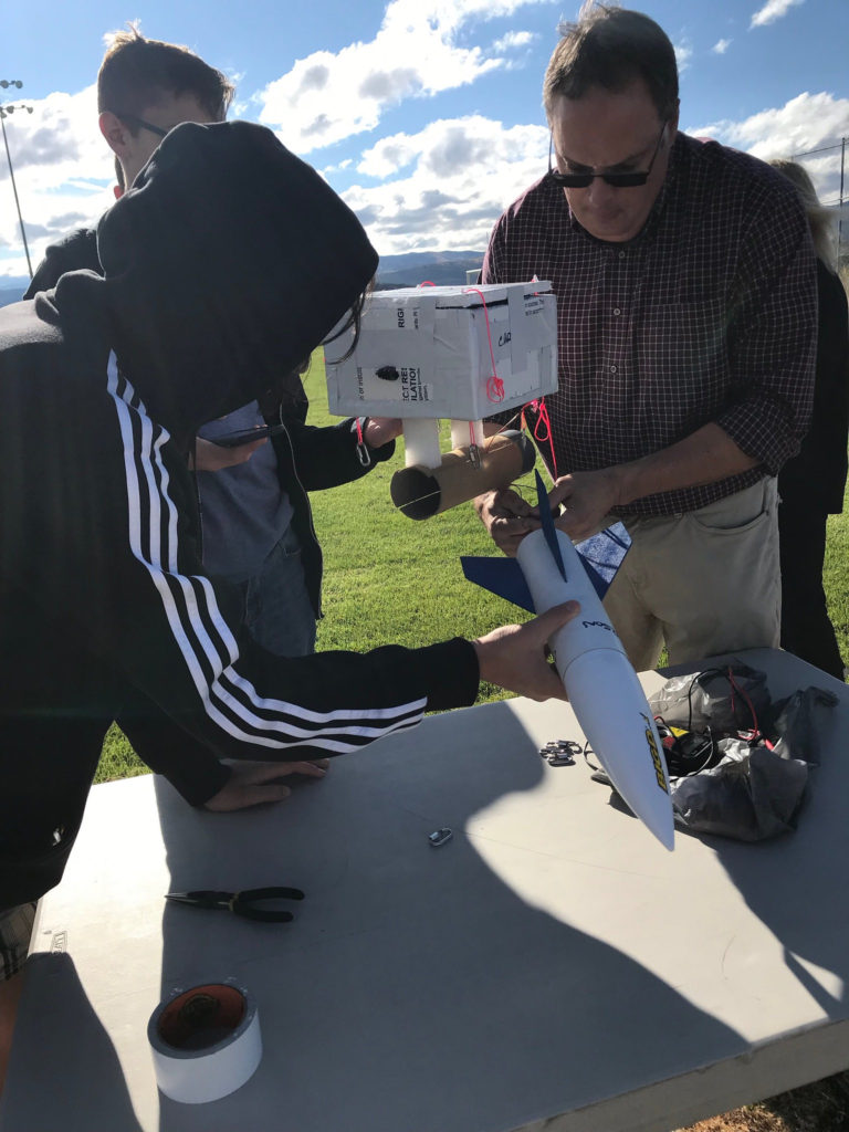
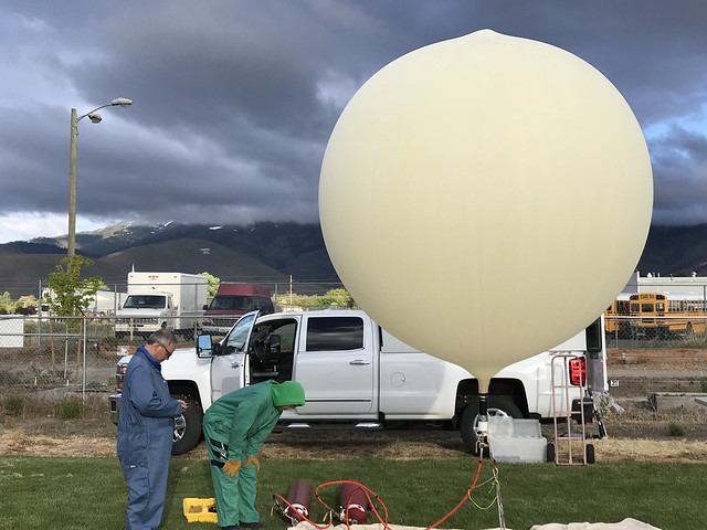
Helium is very hard to get these days so we filled with hydrogen, fortunately our friends at the University of Nevada, Reno, have all the fireproof suits, gloves, masks and grounding wires (so no static) necessary. They filled while I was in the classroom stringing the rocket payload since the students had re-designed and built it since I was last there. We filled early because we knew it might get a bit windy, and it did – easier to have the balloon filled and tethered than to try and fill in the wind.
Then once the drone was airborne to record the launch, we launched.
Launch filmed from drone.
We could tell almost right away it wasn’t following the predicted flight path … then it seemed to adjust in a more favorable direction … but next it turned due west and went exactly where we didn’t want it to go. Into the heavily forested mountains and over lakes.
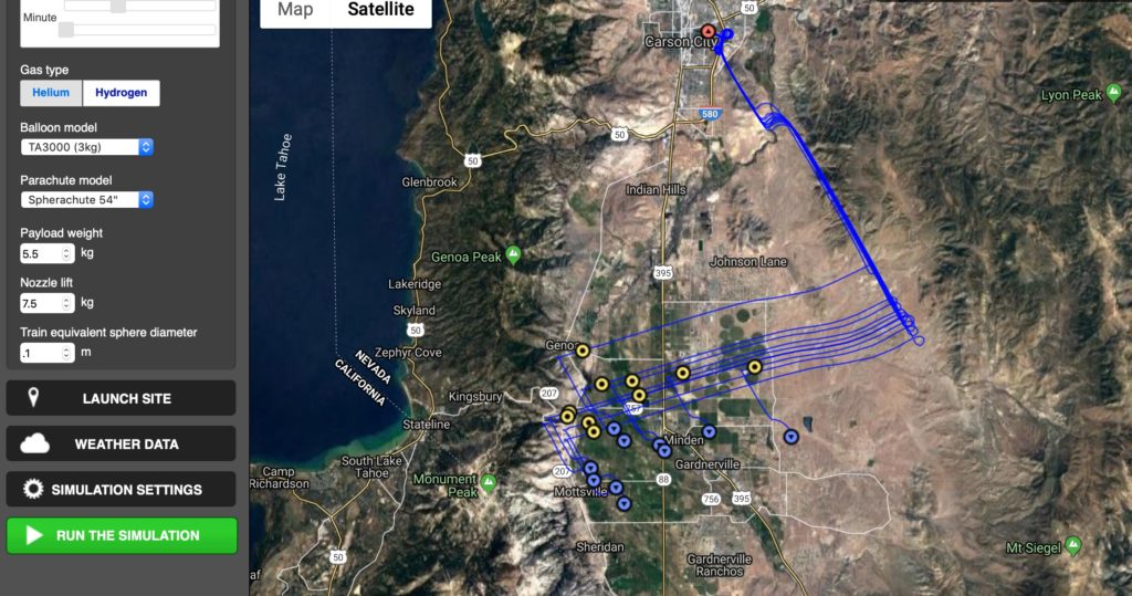
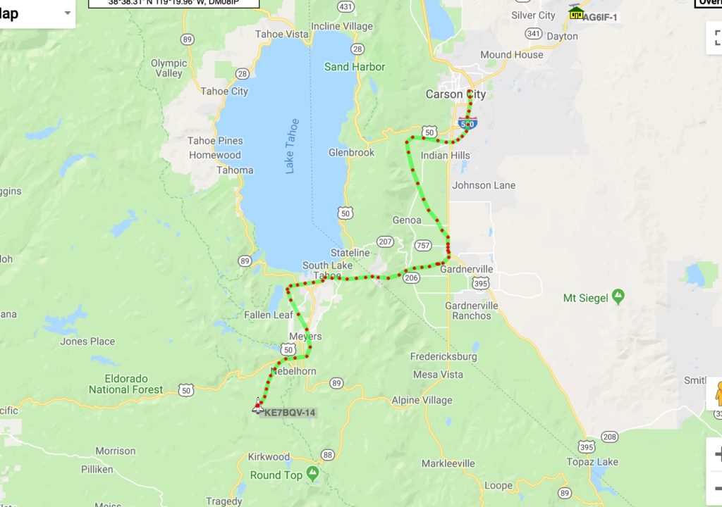
We packed up and began the recovery. We drove to Minden, Nevada, parked and watched the balloon high overhead until we saw it burst at over 100,000 feet. We followed it on aprs.fi (which provided the actual flight track above) and our 2 onboard Spot Trace trackers. Once we had a pretty good idea where it was going we continued the chase.
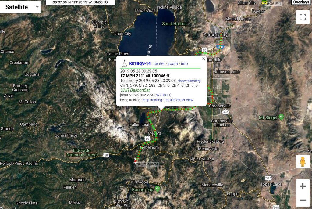
After burst the payloads drop very quickly as there is not enough air to inflate the parachute (at that altitude you’re above 98% of the Earth’s atmosphere, considered “near space”). At about 50,000 feet the parachute starts doing its job. As we neared the reported landing spot we mapped out the closest roads for recovery. As we drove we ran into a large tree blocking one road and a large snow drift blocking the other, so we were on foot. Teacher Collin Belnap accompanied us on the recovery and he put together a video of the recovery attempt.
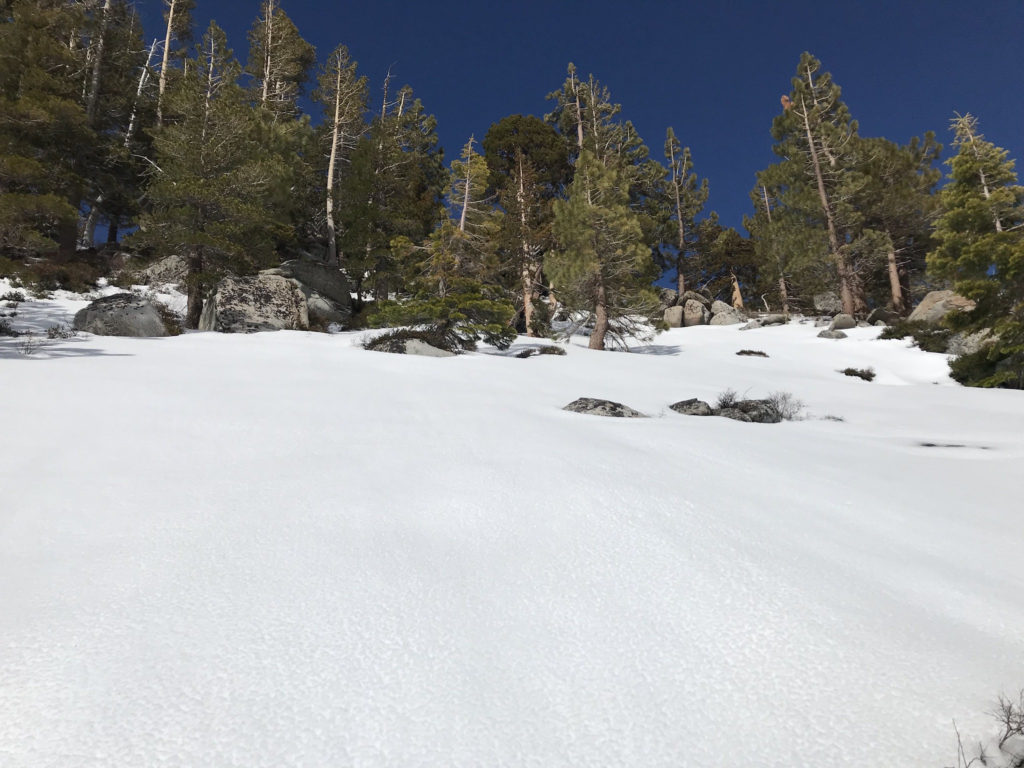
One mile became two and then the GPS pointed up a steep ridge. Despite hours of searching Lou Loftin, who works with me, found the spot the GPS claimed was the landing spot but he found nothing and exhaustion forced him to give up the search.
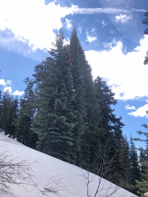
Meanwhile, Dr. Eric Wang, mechanical engineering associate professor from the University of Nevada, Reno, who had helped with the launch was following our progress (or lack thereof) and decided he and a friend could back country ski to the spot which he had pinpointed. They’d approach from above via the Sierra at Tahoe ski area (closed for the season). So this morning they made the trek and all we’ve gotten back from them so far is this photo showing the parachute and payloads hanging in a tree.
We don’t know anything else … were they able to retrieve? Are they on their way back? I’ll keep you posted and share video, data and what we learn about the rocket launch!
Learning is messy!