Find out more about this project here.
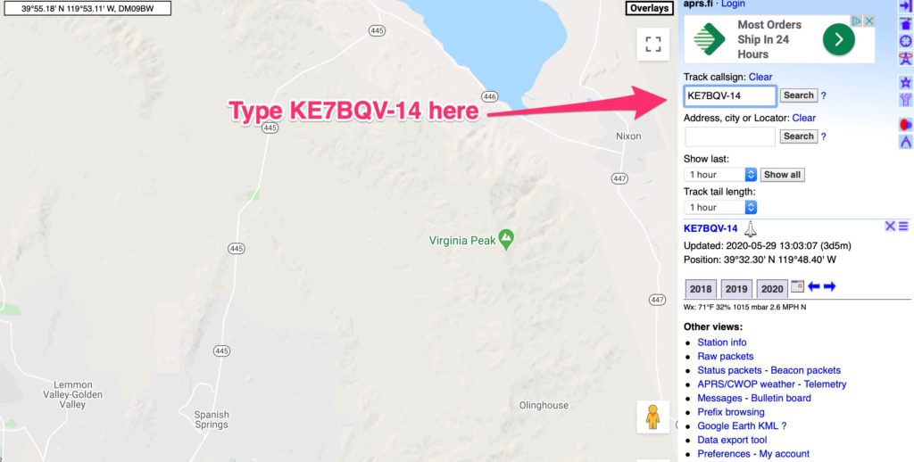
Our launch has been delayed until June 5th and maybe not until the following week because of weather conditions. When we launch, a communications payload keeps us in touch with the balloon’s progress. Besides 2 SPOT Trackers that use satellite technology to pinpoint the balloons location once it lands (2 in case one fails) a HAM radio transceiver sends out a signal that we (and you) can watch live on a Google map. To do so go to aprs.fi on the web and type in KE7BQV-14 (See image below) AFTER WE LAUNCH. You’ll have to keep checking back here to see when we plan to launch. We’ll give you at least a day before notice.
After we launch, about every minute or so, a new red dot will appear on the map tracing the flight.
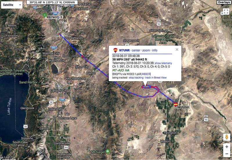
The image above traces a finished flight (usually about 90 tp 120 minutes) and demonstrates the box that opens when you click on a red dot – clicking on the red dots can be a bit frustrating at times, you might have to try more than once and be careful to click right on the dot. Note the information provided: Date and time, speed, compass heading (in this case 265 degrees), and altitude in feet.
In addition, I’ll be tweeting out progress as much as possible: @bcrosby